

Optimizing Sensor Placement for Wildlife Monitoring to Improve Model Inference and Conservation Outcomes
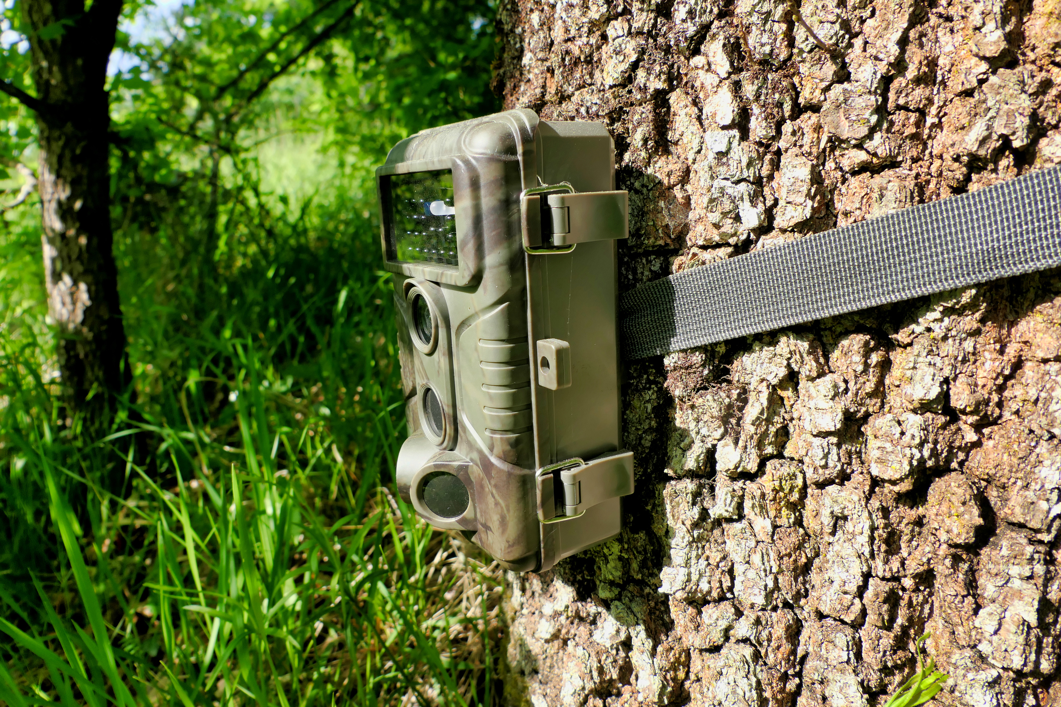
Due to the acceleration of land conversion and environmental changes, our world is at risk of a biodiversity crisis. Scientists need a way to track species conservation efforts at scale that is accurate, cost effective, and accessible. Camera traps, bioacoustic recorders, and hair snares have become common means for monitoring. These methods are non-invasive and inexpensive and allow for wide deployment across remote landscapes.
Goals
The primary goal of this project is to develop and implement solutions to common design challenges in using passive sensors—especially camera traps—for wildlife monitoring. We will create an adaptable methodology for optimizing sensor placement by combining ecological models with AI-driven simulation, optimization, and reinforcement learning. This approach will be tested and refined through real-world conservation efforts focused on sensitive mammal species.
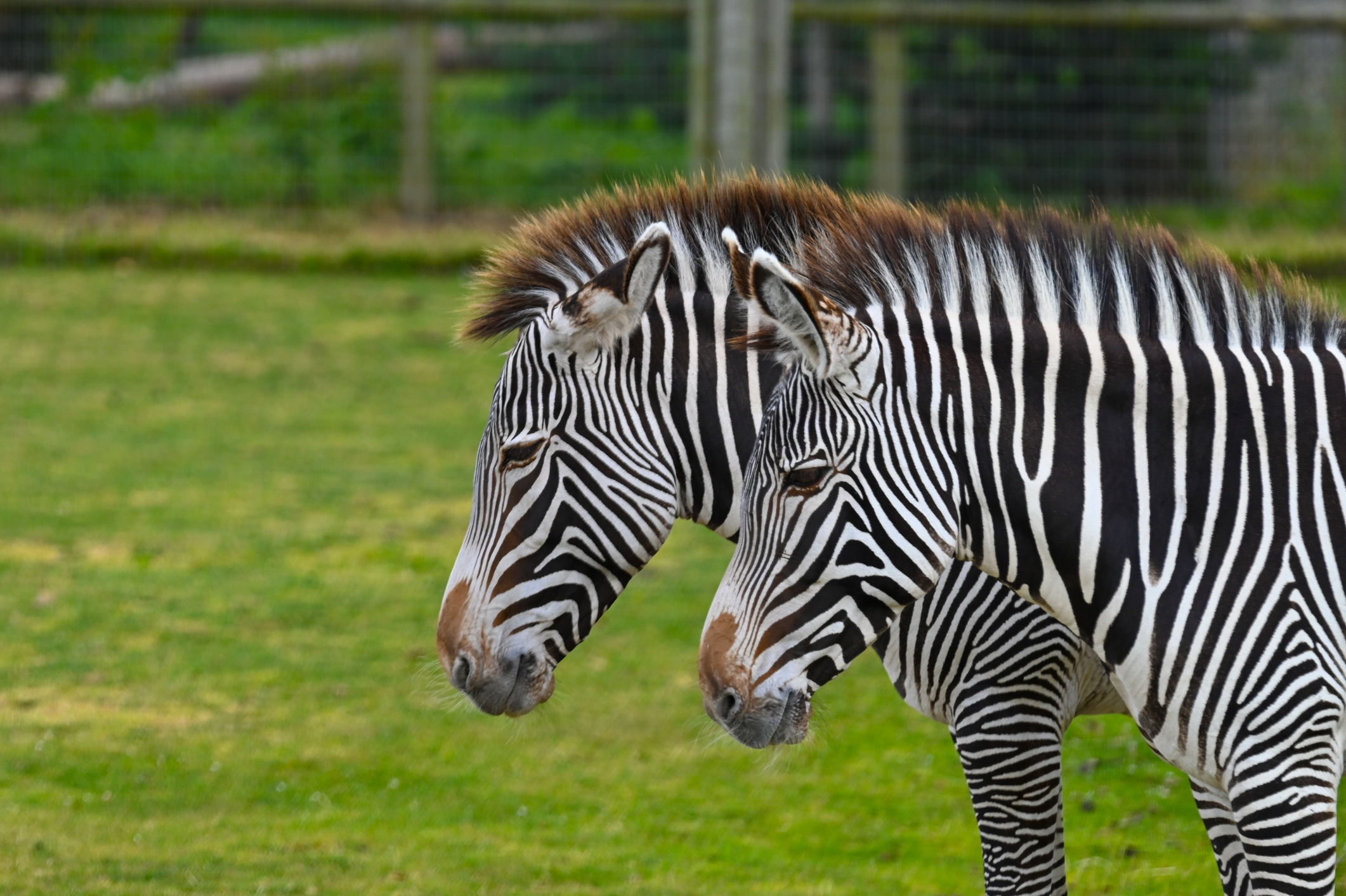
Our interdisciplinary team—comprising ecologists, computer scientists, and conservation practitioners—will collaborate with partners who manage long-term camera trap grids in North America and Africa. Together, we’ll develop population models for species such as grizzly bears (British Columbia), Grevy’s zebras (Kenya), and pumas (Washington), applying our optimization tools to assess improvements in model accuracy and precision.
While camera traps are our initial focus due to their widespread use, the methodology will also be adaptable to other passive sensors like hair snares.
To broaden the impact, we will build an interactive web tool allowing researchers and practitioners to design and visualize optimized sensor layouts for their landscapes. The tool will support both spatial capture-recapture (SCR) for marked species (e.g., zebras with their unique stripes) and models tailored to unmarked species.
Past Research
Designing passive sensor surveys for wildlife monitoring—using tools like camera traps or hair snares—is a complex task. Researchers must place limited sensors across large areas to balance data quality, cost, and effort. Accurate estimates of animal populations depend heavily on sensor placement, yet decisions are often based on convenience or general guidelines rather than rigorous optimization.
Survey design significantly affects the accuracy and bias of ecological data. Common grid-based layouts may not match species’ behavior, while trail-based placements can increase detections but risk bias. Remote deployments also add cost and logistical hurdles. Despite these challenges, few tools help practitioners optimize sensor placement. This gap increases the risk of unreliable population estimates, highlighting the need for accessible, effective design solutions.
Current Study Methods
We propose developing a simulation-based methodology to optimize sensor placement for spatial capture-recapture (SCR) studies, aiming to balance model accuracy with logistical costs for both marked and unmarked populations. By integrating species-specific parameters and real-world deployment constraints, we will create algorithms that identify efficient sensor configurations. These will be tested using simulated and real-world camera trap data, in collaboration with partners like University of British Columbia, MIT, and Panthera.
Our approach will incorporate metaheuristic techniques—including reinforcement learning—to minimize estimation error while remaining practical for field use. We will also explore adaptive sampling strategies that adjust sensor networks over time to improve data quality or reduce costs. Model performance will be evaluated against known simulated populations to assess trade-offs between cost and information gain.
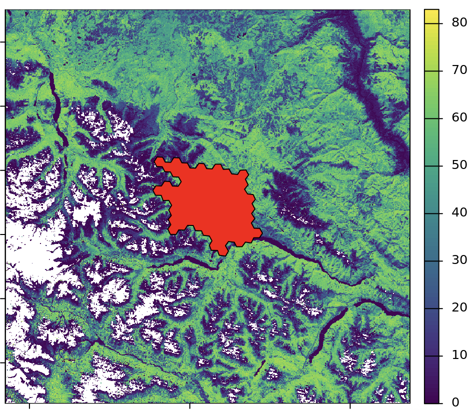
Geospatial visualization of the South Chilcotin Mountains in British Columbia, Canada. Red dots represent potential camera trap locations in our study.
To ensure broad applicability, we will build a public-facing, interactive web tool that lets users input their own study parameters—such as movement data and deployment costs—and explore optimized designs. Initially focused on marked SCR models, the tool will also include early support for unmarked cases. Developed with input from conservation partners, the tool will offer a user-friendly platform for planning sensor studies and comparing design options based on specific conservation goals and constraints.
Conservation Science Partners:
Angela Brennan
Justin Suraci
Brett Dickson
Arielle Parsons
USC:
Bistra Dilkina
Hannah Murray
Microsoft AI for Good Lab:
Amrita Gupta
University of British Columbia:
Robin Naidoo
Massachusetts Institute of Technology:
Sara Beery
Panthera:
Mark Elbroch
Paul G. Allen Family Foundation
Optimizing Wildlife Camera Traps for Greater Conservation Outcomes, Paul G. Allen Family Foundation, May 12, 2025